Appalachain Trail - Mount Carlo To Pleasant Pond
SKU
844081
$14.95
Free Shipping*
Available to ship now
Free Store Pick-Up
At any of our Tucson locations
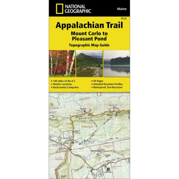
The Mount Carlo to Pleasant Pond Topographic Map Guide makes a perfect traveling companion when traversing the southern Maine section of the Appalachian Trail (A.T.). The A.T. through Maine offers some of the most challenging sections of trail along the A.T., both in rugged terrain and weather conditions, and is not recommended for the unprepared hiker.
Each A.T. Topographic Map Guide includes detailed topographic maps at a detail of 1 inch = 1 mile. Each page is centered on the A.T. and overlaps with the adjacent pages so there is little chance of getting lost. Along the bottom of each page is a trail profile that shows the distance between shelters, camping areas, and trail access points. The map and trail profile provide a step by step visual guide to hiking the trail, mile by rugged mile. The Topographic Map Guide is built for all levels of hiking enthusiasts, from the day tripper to the multi month 'thru-hiker'. The front pages of the printed Topographic Map Guide include resupply information, town inset maps, camping options, and much more.
Every Topographic Map Guide is printed on 'Backcountry Tough' waterproof, tear-resistant paper. A full UTM grid is printed on the map to aid with GPS navigation.
Specifications
| Scale | 1:63,350 |
| Dimensions (Flat) | 25 1/2" x 37 3/4" |
| Dimensions (Closed) | 4 1/4" x 9 3/8" |
Brand
National Geographic Maps