Trails Illustrated Map: Yosemite SW - Yosemite Valley & Wawona
SKU
pg57543
Free Shipping*
Available to ship now
Free Store Pick-Up
At any of our Tucson locations
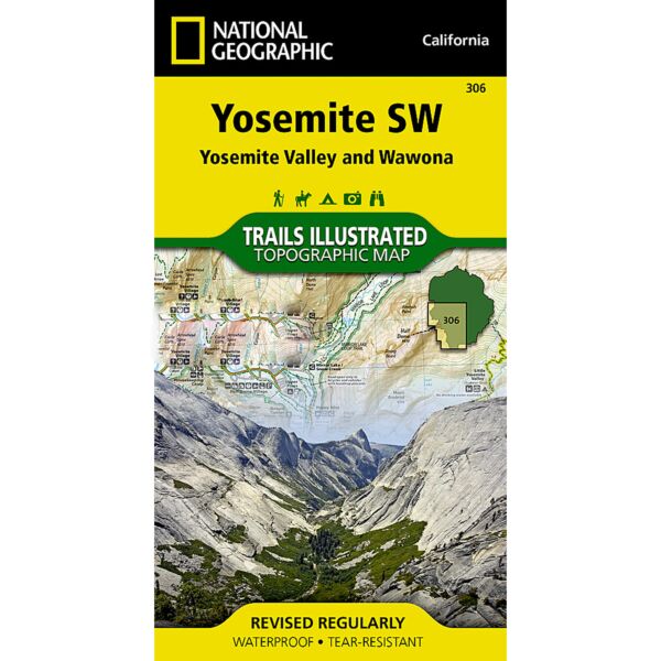
This Trails Illustrated topographic map is the most comprehensive recreational map for the Yosemite Valley and Wawona area of Southwest Yosemite National Park. Coverage includes: Half Dome; El Capitan; Yosemite, Vernal and Nevada Falls; Little Yosemite Valley; Tenaya Canyon; Indian Rock; Yosemite Creek; Glacier Point; Merced Gorge; Tamarack Flat; Tuolumne Grove of Giant Sequoias; Big Oak Flat Entrance; Aspen Valley; White Wolf; Tioga Pass Road; May Lake; El Portal; Foresta; Mariposa Grove of Giant Sequoias; Chilnualna Falls; Buena Vista Pass; Badger Pass; Bridalveil Creek and John Muir Trail. Includes information on: wilderness boundaries; no camping zones; no campfire zones; and trail mileage.
Specifications
| Folded Dimensions | 4.5 x 9 x 0.3 in |
| Unfolded Dimensions | 26 x 32 in |
Features
- Waterproof and tear-resistant
- Clearly marked trails for hiking, biking, horseback riding, ATV, and more
- Detailed topography and clearly defined, color-coded boundaries of state parks, national recreation areas, wilderness areas, marine sanctuaries, and wildlife refuges
- Hundreds of points of interest, including scenic viewpoints, campgrounds, boat launches, swimming areas, fishing access points, and more
- UTM and latitude/longitude grid, as well as selected waypoints and a scale bar for easy and accurate navigation
- Detailed road network
- Important safety information and travel tips
Brand
National Geographic Maps