Guide Map: Southern California Road Map & Travel Guide
SKU
pg69337
As low as $9.95
Free Shipping*
Available to ship now
Free Store Pick-Up
At any of our Tucson locations
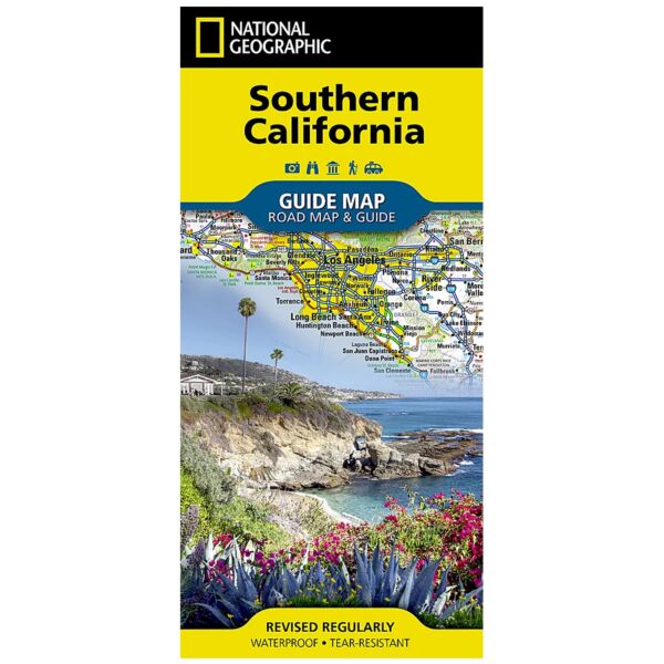
National Geographic's Southern California Guide Map provides travelers with the perfect combination of detail and perspective in a highly functional travel tool. Both comprehensive map and mini-guidebook, this map provides information on many points of interest, the cities of Los Angeles and San Diego, and Sequoia and Kings Canyon national parks. Road network designations are clear and distances in miles on major highways are shown. Cities and towns are easy to find with the map's helpful index and hundreds of attractions are noted.
Inset maps of the Los Angeles area, San Diego, Oxnard-Ventura, Bakersfield, Santa Barbara, the Monterrey Bay area, and Palm Springs provide greater detail of these key areas of the region. The California 1 South scenic drive from Monterrey to Morro Bay is highlighted with its own map as well. A handy chart of park service sites and climate information are also included.
Every State Guide Map is printed on durable synthetic paper, making them waterproof, tear-resistant and tough — capable of withstanding the rigors of any kind of travel.
Specifications
| Product Number | GM00620379 |
| ISBN | 9781597750158 |
| UPC | 749717054462 |
| Dimensions | Folded: 4 x 8.75 in |
| Flat: 17.75 x 24.75 in | |
| Scale | 1:1,584,000 |
| Publication Date | 2020 |
Features
- Waterproof Tear-Resistant Travel Map
Brand
National Geographic Maps