Trails Illustrated Map: Sycamore Canyon/Verde Valley - Coconino, Kaibab & Prescott National Forests
SKU
pg37449
As low as $14.95
Free Shipping*
Available to ship now
Free Store Pick-Up
At any of our Tucson locations
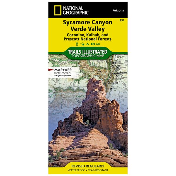
Created in partnership with the U.S. Forest Service and others, National Geographic's Trails Illustrated Map of Sycamore Canyon and Verde Valley is an essential travel companion for all outdoor enthusiasts exploring this rugged yet picturesque area in Northern Arizona. Expertly researched, the map delivers unparalleled detail of Coconino, Kaibab and Prescott National Forests; Sycamore Canyon, Red Rock - Secret Mountain, Cedar Bench and Pine Mountain Wilderness Areas; Montezuma Castle National Monument; and Red Rock Scenic Byway.
Get off the beaten path and back on by following along the clearly mapped trails, colored for motorized or non-motorized use. The Great Western Trail is marked as are National Recreation Trails. The Verde National Scenic River is shown with mileage markers and river access points. To aid in your navigation, the map includes contour lines, elevations, labeled peaks and summits, water features, areas of wooded cover, numbered Forest Service roads and OHV routes, selected waypoints and color-coded boundaries between different land management agencies. Among the recreation features pinpointed are campgrounds, interpretive trails, trailheads, swimming areas, sno-parks, lookout towers and scenic viewpoints. Background information of the forests and wilderness areas is also provided along with safety and essential contact information.
Every Trails Illustrated map is printed on "Backcountry Tough" waterproof, tear-resistant paper. A full UTM grid is printed on the map to aid with GPS navigation.
Other features found on this map include: Camp Verde, Cedar Bench Wilderness, Coconino National Forest, Cottonwood, Horse Mesa, Kaibab National Forest, Mazatzal Wilderness, Munds Mountain Wilderness, Pine Mountain Wilderness, Prescott National Forest, Red Rock-Secret Mountain Wilderness, Rogers Lake, Sedona, Sycamore Canyon, Sycamore Canyon Wilderness, Tonto National Forest.
Specifications
| Product Number | TI00000854 |
| ISBN | 9781566955133 |
| UPC | 749717012868 |
| Dimensions | Folded: 4.25 x 9.25 in |
| Flat: 25.5 x 37.75 in | |
| Scale | 1:70,000 |
| Date | 2019 |
Features
- Waterproof and tear-resistant
- Clearly marked trails for hiking, biking, horseback riding, and more
- Detailed topography and clearly defined, color-coded boundaries of state parks, national recreation areas, wilderness areas, marine sanctuaries and wildlife refuges - Hundreds of points-of-interest, including scenic viewpoints, campgrounds, boat launches and canoe carry downs, swimming areas, fishing access points, and more
- UTM and Latitude/Longitude grid, as well as selected waypoints and a scale bar for easy and accurate navigation
- Detailed road network
- Useful travel information on parks and key trails
- Important safety information and tips
- Information about local organizations and land management agencies
Brand
National Geographic Maps