Trails Illustrated Map: Santa Monica Mountains National Recreation Area
SKU
pg57578
As low as $5.00
Free Shipping*
Available to ship now
Free Store Pick-Up
At any of our Tucson locations
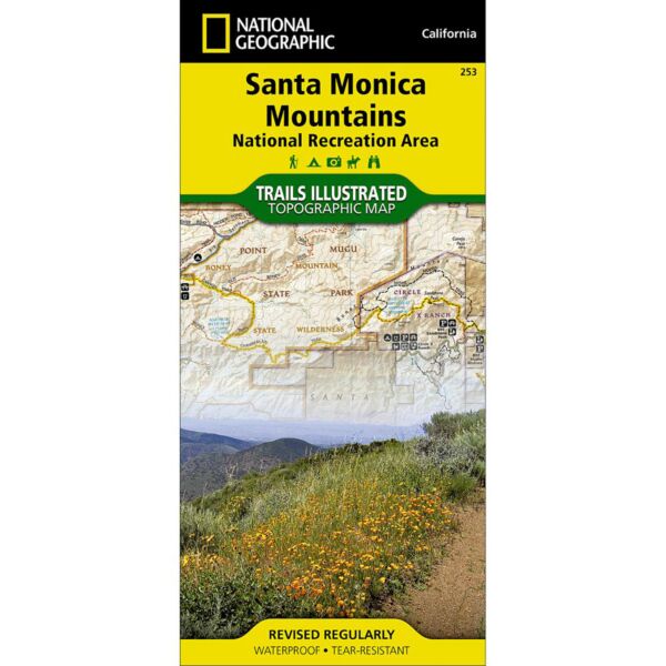
The Santa Monica Mountains National Recreation Area Trails Illustrated Map details the largest urban park in the United States from Point Mugu to Will Rogers State Beach.
This map contains latitude/longitude and UTM grids, park activity guide, safety information, and completely researched and revised trails, recreational points-of-interest, boundaries, and roads.
Areas include: Runyon Canyon, Fryman Canyon, Franklin Canyon, Fossil Ridge, Mission Canyon, Marvin Braude Mulholland Gateway Park, Westridge Canyonback Park, Rustic Canyon Park, Temescal Canyon Park, Topanga State Park, Tuna Canyon, Malibu Creek State Park, Corral Canyon, Las Virgenes Canyon Open Space, Zuma/Trancas Canyons, Point Mugu State Park, Leo Carrillo State Park, and more.
Specifications
| Folded Dimensions | 4 x 9 in |
| Unfolded Dimensions | 38 x 26 in |
| Scale | 1:40,000 |
Features
- Waterproof and tear-resistant
- Clearly marked trails for hiking, biking, horseback riding, ATV, and more
- Detailed topography and clearly defined, color-coded boundaries of state parks, national recreation areas, wilderness areas, marine sanctuaries, and wildlife refuges
- Hundreds of points of interest, including scenic viewpoints, campgrounds, boat launches, swimming areas, fishing access points, and more
- UTM and latitude/longitude grid, as well as selected waypoints and a scale bar for easy and accurate navigation
- Detailed road network
- Important safety information and travel tips
Brand
National Geographic Maps