John Muir Trail: Topographic Map Guide
SKU
805066
$14.95
Free Shipping*
Available to ship now
Free Store Pick-Up
At any of our Tucson locations
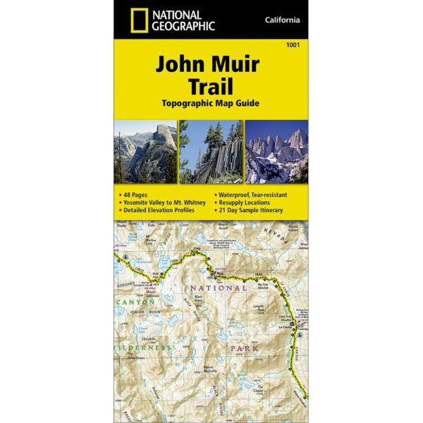
National Geographic's Map Guide of the John Muir Trail is an indispensable tool for navigating one of the most famous trails in the United States. Expertly researched and created in partnership with local land management agencies, this product provides detailed topographic maps, interesting history, a waypoint table, information about resupply and bear safety, and key points of interest you will encounter along the trail. Formatted to meet your needs while navigating this breathtaking and remote trail, the maps within the guide are one-inch-equals-one-mile (1:63,360) making it easy to calculate distances.. Each map page has a trail profile that shows the elevation changes you will encounter. Also, the John Muir Trail is highlighted and centered on each page so you can easily track your progress. The maps start at the northern terminus in Yosemite Valley and progress along the ridge of the Sierra Nevada, past Devils Postpile, and end at the highest point in the lower 48 on the top of Mount Whitney. Along the way you will pass through; Yosemite National Park, Ansel Adams Wilderness, Devils Postpile National Monument, John Muir Wilderness, Kings Canyon National Park, and finally, Sequoia National Park and Mount Whitney. All proceeds from the purchase of National Geographic maps help support the Society's vital exploration, conservation, scientific research, and education programs.
Specifications
| Folded Dimensions | 4 x 9 in |
| Unfolded Dimensions | 37 x 25 in |
| Scale | 1:63,360 |
Features
- Waterproof and tear-resistant
- Clearly marked trails for hiking, biking, horseback riding, ATV, and more
- Detailed topography and clearly defined, color-coded boundaries of state parks, national recreation areas, wilderness areas, marine sanctuaries, and wildlife refuges
- Hundreds of points of interest, including scenic viewpoints, campgrounds, boat launches, swimming areas, fishing access points, and more
- UTM and latitude/longitude grid, as well as selected waypoints and a scale bar for easy and accurate navigation
- Detailed road network
- Important safety information and travel tips
Brand
National Geographic Maps