Trails Illustrated Map: Issaquah Alps/Mount Si
SKU
805128
Special Price $5.00 Regular Price $14.95
Free Shipping*
Available to ship now
Free Store Pick-Up
At any of our Tucson locations
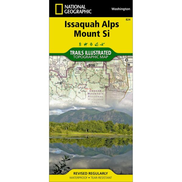
National Geographic's Trails Illustrated map of Cougar Mountain Wildland Park, Tiger Mountain State Forest, Rattlesnake Mountain, and Mount Si in Washington State's Issaquah Alps region is a two-sided, waterproof map designed to meet the needs of outdoor enthusiasts with unmatched durability and detail. This map was created in conjunction with local land management agencies and is loaded with valuable recreation information. Trails Illustrated maps are expertly researched and frequently updated. The maps are printed in the United States on durable synthetic paper, making them waterproof, tear-resistant, and trail tough—capable of going anywhere you do.
Specifications
| ISBN | 978-1566956338 |
| Folded Dimensions | 4 x 9 in |
| Unfolded Dimensions | 26 x 38 in |
| Scale | 1:30,000 |
Features
- Waterproof and tear-resistant
- Clearly marked trails for hiking, biking, horseback riding, ATV, and more
- Detailed topography and clearly defined, color-coded boundaries of state parks, national recreation areas, wilderness areas, marine sanctuaries, and wildlife refuges
- Hundreds of points of interest, including scenic viewpoints, campgrounds, boat launches, swimming areas, fishing access points, and more
- UTM and latitude/longitude grid, as well as selected waypoints and a scale bar for easy and accurate navigation
- Detailed road network
- Important safety information and travel tips
Brand
National Geographic Maps