Trails Illustrated Map: Denali National Park & Preserve
SKU
pg27616
As low as $14.95
Free Shipping*
Available to ship now
Free Store Pick-Up
At any of our Tucson locations
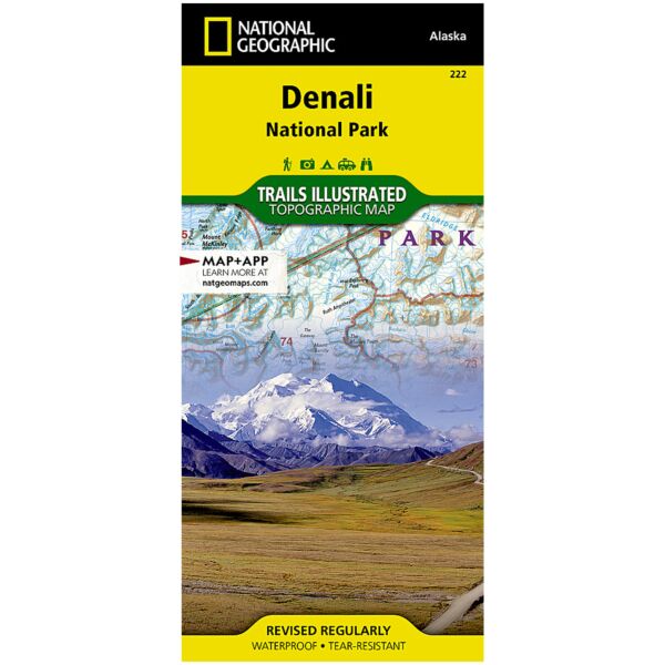
This Trails Illustrated topographic map for Denali National Park in the Alaska Range, crowned by Mount McKinley, which at 20,320 feet is America's highest peak. The map includes the entire national park area, with a close up view of the area in an around Mount McKinley. It also includes information about Denali National Park and Preserve, as well as useful tips about animal encounters, river crossings, hypothermia, and more.Includes UTM grids for use with your GPS unit.
Specifications
| Folded Size | 4.25" x 9.25" |
| Unfolded Size | 25.5" x 37.75" |
| Scale | 1:225,000 |
Features
- Waterproof and tear-resistant
- Clearly marked trails for hiking, biking, horseback riding, and more
- Detailed topography and clearly defined, color-coded boundaries of state parks, national recreation areas, wilderness areas, marine sanctuaries and wildlife refuges - Hundreds of points-of-interest, including scenic viewpoints, campgrounds, boat launches and canoe carry downs, swimming areas, fishing access points, and more
- UTM and Latitude/Longitude grid, as well as selected waypoints and a scale bar for easy and accurate navigation
- Detailed road network
- Useful travel information on parks and key trails
- Important safety information and tips
- Information about local organizations and land management agencies
Brand
National Geographic Maps