Davenport Hill, AZ - 7.5' Topo 1989
SKU
pg54076
As low as $10.00
Free Shipping*
Available to ship now
Free Store Pick-Up
At any of our Tucson locations
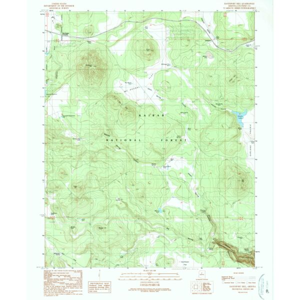
7.5' topographical quadrangle of Davenport Hill and surrounding areas, Coconino County, Arizona
Specifications
| Scale | 1:24,000 |
| ISBN | 978-0-607-07746-9 |
| Date Published | 1989 |
| Latitude | 35° 7' 30? N to 35° 15' 0? N |
| Longitude | 112° 7' 30? W to 112° 0' 0? W |
Features
- North American Datum of 1983 (NAD 83). Projection and 1000-meter grid: Universal Transverse Mercator, zone 12 2500-meter ticks: Arizona Coordinate System of 1983 (east zone)
- North American Datum of 1927 (NAD 27) is shown by dashed corner ticks. The values of the shift between NAD 83 and NAD 27 for 7.5-minute intersections are obtainable from National Geodectic Survey NADCON software
Brand
USGS