Trails Illustrated Map: Canyons of the Escalante - Grand Staircase-Escalante National Monument
SKU
pg7003
Free Shipping*
Available to ship now
Free Store Pick-Up
At any of our Tucson locations
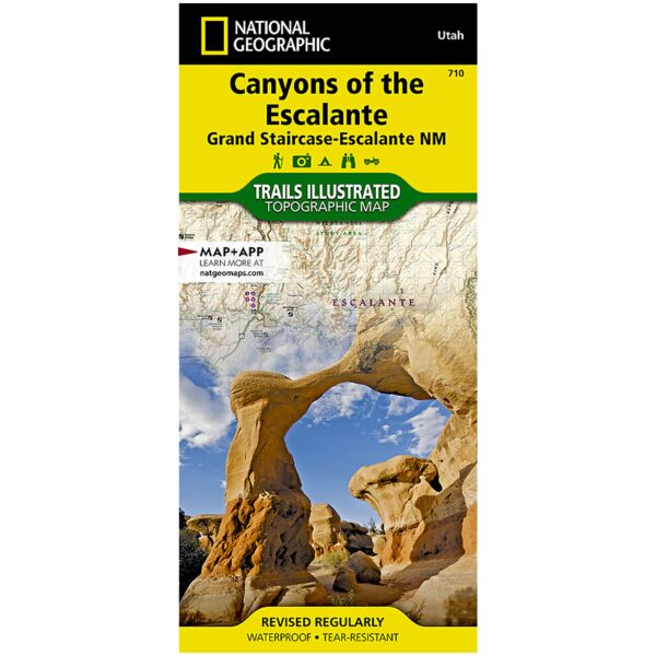
Coverage includes BLM - Escalante Resource Area, Dixie National Forest, Glen Canyon National Recreation Area; Box Hollow Wilderness Area, Death Hollow Natural Area and Wolverine Petrified Wood Natural Area; Boulder Town, Escalante and Devils Garden; Fiftymile Bench, Escalante Canyons and surrounding area, Escalante River and northwest Lake Powell. Includes UTM grids for use with your GPS unit.
Specifications
| Folded Size | 4.25" x 9.25" |
| Unfolded Size | 37.75" x 25.5" |
| Scale | 1:75,000 |
| Revision Date | 1/1/2010 |
| ISBN | 9781566953245 |
Features
- Waterproof and tear-resistant
- Clearly marked trails for hiking, biking, horseback riding, and more
- Detailed topography and clearly defined, color-coded boundaries of state parks, national recreation areas, wilderness areas, marine sanctuaries and wildlife refuges - Hundreds of points-of-interest, including scenic viewpoints, campgrounds, boat launches and canoe carry downs, swimming areas, fishing access points, and more
- UTM and Latitude/Longitude grid, as well as selected waypoints and a scale bar for easy and accurate navigation
- Detailed road network
- Useful travel information on parks and key trails
- Important safety information and tips
- Information about local organizations and land management agencies
Brand
National Geographic Maps