Appalachain Trail - Delaware Water Gap To Schaghticoke Mountain
SKU
844088
$14.95
Free Shipping*
Available to ship now
Free Store Pick-Up
At any of our Tucson locations
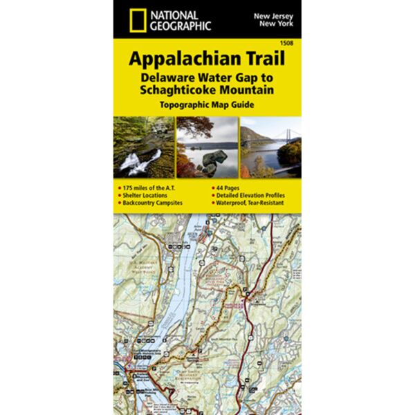
The Delaware Water Gap to Schaghticoke Mountain Topographic Map Guide makes a perfect traveling companion when traversing the New Jersey and New York sections of the Appalachian Trail (A.T.). The trail through New Jersey and New York is surprisingly rugged, and much more remote than one would imagine given its proximity to large population centers. For 160 miles the trail follows long mountain ridges; travels across bogs, wetlands, and broad river valleys; and meanders through numerous state parks, forests, and national park land.
Each A.T. Topographic Map Guide includes detailed topographic maps at a detail of 1 inch = 1 mile. Each page is centered on the A.T. and overlaps with the adjacent pages so there is little chance of getting lost. Along the bottom of each page is a trail profile that shows the distance between shelters, camping areas, and trail access points. The map and trail profile provide a step-by-step visual guide to hiking the trail, mile by rugged mile. The Topographic Map Guide is built for all levels of hiking enthusiasts, from the day-tripper to the multi month through-hiker. The front pages of the printed Topographic Map Guide include resupply information, town inset maps, camping options, and much more.
Every Topographic Map Guide is printed on backcountry-tough waterproof, tear-resistant paper. A full UTM grid is printed on the map to aid with GPS navigation.
Specifications
| Scale | 1:63,660 |
| Dimensions (Flat) | 25 1/2" x 37 3/4" |
| Dimensions (Closed) | 4 1/4" x 9 1/4" |
Brand
National Geographic Maps