507 - Trails Illustrated Map: Moab East: Dewey Bridge, Sand Flats
SKU
1487176
$14.95
Free Shipping*
Available to ship now
Free Store Pick-Up
At any of our Tucson locations
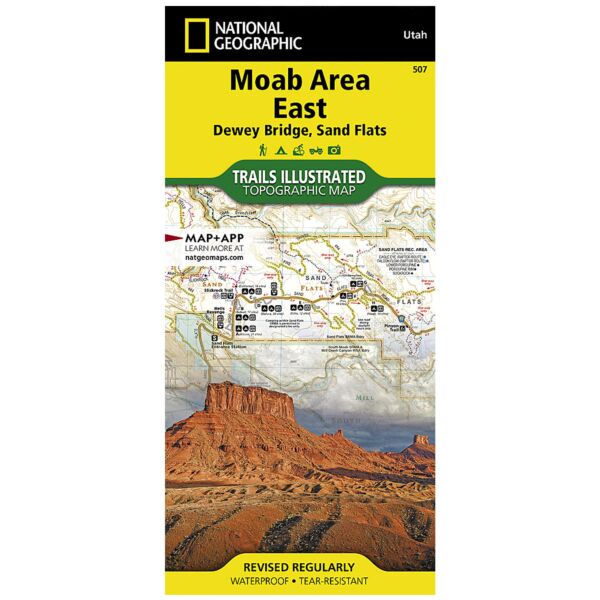
A premier destination for mountain biking, hiking, whitewater rafting, four-wheeling, and more, Moab offers adventure and recreation in one of the most iconic landscapes in the United States. National Geographic's Trails Illustrated maps of Moab were created in partnership with local land management agencies and adventure experts to provide unmatched detail of the area, with useful up-to-date information to guide and enrich your visit. On the Moab Area East map, particular attention is given to the area’s extensive mountain bike trail systems, which are clearly mapped and labeled. This includes the major trail systems east of Moab, including Sand Flats, Behind the Rocks, Whole Enchilada, Fisher Towers, Fisher Mesa, Slickrock, Ken's Lake Recreation Area, Upper Two Mile trails (State land trails), Manti-La Sal National Forest, and the Windows and Delicate Arch Trails in Arches National Park. Trails are symbolized by use (hiking, mountain biking, OHV), with trail difficulty indicated for mountain bike trails. Trail segments are labeled with distances between junctions, and all trailheads and trail junctions are labeled with elevations. 4x4 trails are highlighted in yellow with notes for obstacles and features along the route. Group, primitive, and developed campgrounds are shown with their amenities, and the total number of sites. Colorado River access points and mileages are mapped and labeled for river recreation. Visitor centers, interpretive trails, and scenic overlooks are prominently mapped and labeled with their amenities. OHV, biker, and desert safety tips, laws, and etiquette are also provided. Every Trails Illustrated map is printed on "Backcountry Tough" waterproof, tear-resistant paper. A full UTM grid is printed on the map to aid with GPS navigation. Other features found on this map include: Colorado River, Dolores River, La Sal Mountains, Mount Peale, Salt Valley.
Specifications
| Product Number | TI00000507 |
| ISBN | 9781566959025 |
| UPC | 749717055100 |
| Dimensions | Folded: 4.25 x 9.25 in |
| Flat: 37.75 x 25.5 in | |
| Scale | 1:37,5000 |
| Date | 2022 |
Features
- Waterproof
- Tear-Resistant
- Topographic Map
Brand
National Geographic Maps