1701 - Trails Illustrated Map: Rocky Mountain National Park Day Hikes - 2020 Edition
SKU
1488801
$14.95
Free Shipping*
Available to ship now
Free Store Pick-Up
At any of our Tucson locations
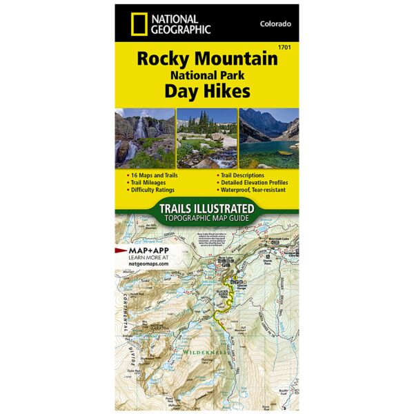
Thrust skyward by Earth’s forces between 40 and 70 million years ago, then sculpted by three glacial episodes, the Rocky Mountains are "new" in geologic terms, and form one of the world's longest ranges—stretching almost unbroken from Alaska to below the nation's southern border. Rocky Mountain National Park preserves a small but important neighborhood within this range. Just outside the park, the towns of Estes Park and Grand Lake are the primary hubs before entry and are connected by Trail Ridge Road—one of ten America's Byways in Colorado and a national designated All-American Road. The Rocky Mountain National Park Day Hikes Topographic Map Guide includes sixteen diverse hikes for all hiking enthusiasts, from the easy, 4.7 mile long Cub Lake Trail to the strenuous, 8.4 mile long Chasm Lake Trail that brings hikers to base of the 14,259 foot Longs Peak. Each hike has a detailed map, a trail profile visualizing the changes in elevation, and a short summary of the interesting features encountered along the trip. Some of the must-visit sites in this Topographic Map Guide are: Ouzel Falls and Calypso Falls—two scenic waterfalls in one hike in the Wild Basin; and Lulu City—a historic site within the park where prospectors lived and mined silver and gold during the late 19th Century. More convenient and easier to use than folded maps, but just as compact and lightweight, National Geographic’s Topographic Map Guide booklets are printed on "Backcountry Tough" waterproof, tear-resistant paper with stainless steel staples. A full UTM grid is printed on the map to aid with GPS navigation.
Specifications
| Product Code | TI00001701 |
| ISBN | 9781566958004 |
| UPC | 749717000032 |
| Dimensions | 4.25 x 9.38 in |
| Scale | 1:50,000 |
| Date | 2020 |
| Pages | 48 |
Features
- Waterproof
- Tear-Resistant
- Topographic Map
Brand
National Geographic Maps